Fremont River

Fremont River

From the Fish Lake country through Rabbit Valley and Capitol Reef to Hanksville, where it becomes the Dirty Devil.

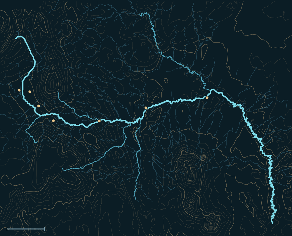
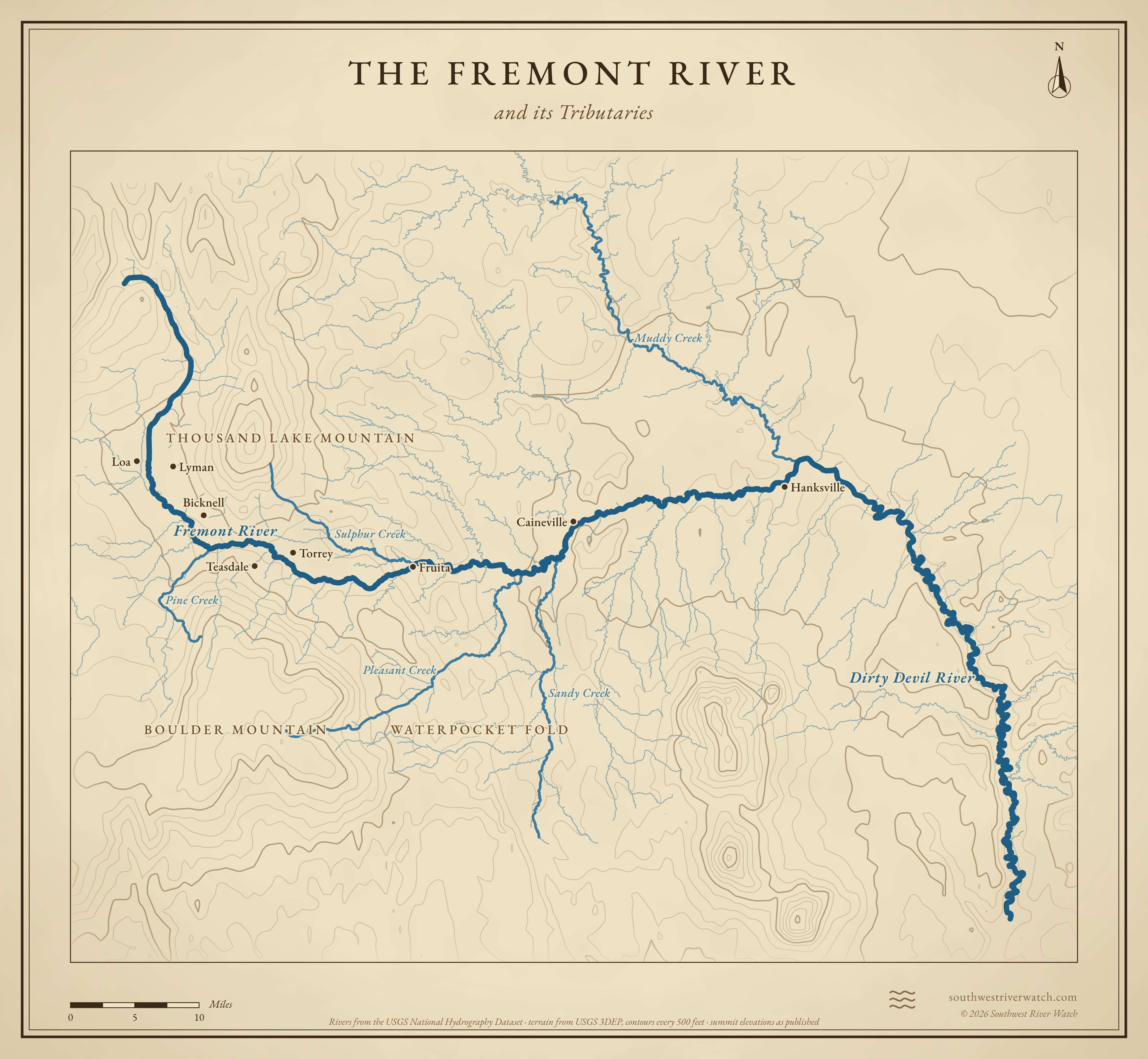
Map of the Fremont RiverBoulder MountainThousand Lake MountainWaterpocket FoldFremont RiverDirty Devil RiverLoaLymanBicknellTeasdaleFruitaCainevilleHanksvilleMuddy CreekSandy CreekPleasant Creek10 miles
Fremont River. River lines from the USGS National Hydrography Dataset.

People and the river

  1. About A.D. 300–1300Fremont people farmed along the river in what is now Capitol Reef, and left their rock art and pithouses.1
  2. July 28, 1869Powell's boats passed the mouth of the river below Hanksville; a boatman, asked if it was a trout stream, called it “a dirty devil,” and the name stuck.2
  3. 1871 onProspectors, cowboys and settlers began carving their names into the walls of Capitol Gorge, the Pioneer Register.3,4
  4. 1882Ebenezer Hanks and his two wives settled in Graves Valley, named for a Powell survey man; it became Hanksville in 1885.5,6
  5. 1883Elijah Cutler Behunin and a small crew cleared more than three miles of Capitol Gorge for a wagon road in eight days.4,7
  6. Late 1800sMormon settlers founded a community where Sulphur Creek meets the Fremont; there was already a Junction, Utah, so they named it Fruita, for the orchards they lived by.8
  7. 1890sButch Cassidy and the Wild Bunch holed up at Robbers Roost, east of Hanksville, reached most easily up the Dirty Devil.9,10
  8. 1904Thomas Nixon and Jack Sumner began digging the Oyler mine above Grand Wash, hunting radium.11
  9. 1928–1969Dewey Gifford farmed and ran stock at Fruita; his 1908 house is the last original home in the valley.12
  10. Aug 2, 1937President Franklin Roosevelt set aside 37,711 acres as Capitol Reef National Monument.13
  11. 1971President Nixon signed the bill making Capitol Reef a national park.13

Frontier stories

“A dirty devil”

On July 28, 1869, Powell's boats passed the mouth of a muddy river coming in from the west. Powell wrote: “One of the men in the boat following, seeing what we have done, shouts to Dunn and asks whether it is a trout stream. Dunn replies, much disgusted, that it is ‘a dirty devil.’” Powell later tried to name it for John C. Frémont; the name only stuck on the upper river, the Fremont, and the lower one is still the Dirty Devil.2

Robbers Roost

East of Hanksville, between the Dirty Devil and the Green, lies Robbers Roost, the hideout Butch Cassidy and the Wild Bunch used in the last years of the Old West. They built cabins there for the winters. The easiest way in was up the mouth of the Dirty Devil; Hanksville was the nearest town.

Cassidy Arch, 400 feet above Grand Wash in Capitol Reef, is named for him: local lore and archaeology suggest he hid out in the park's canyons too.9,10,17

Names on the wall

Capitol Gorge was the only way through the Waterpocket Fold for wagons, and a bad one: narrow, boulder-choked and swept by flash floods. In 1883 Elijah Cutler Behunin and a few men spent eight days clearing more than three miles of it. From 1871 on, travelers stood on their wagons and carved their names into the walls above the flood line: prospectors, cowboys, settlers, trappers. The Pioneer Register is a half-mile walk in; adding to it now is illegal.4,7,3

Hanksville

In 1882 Ebenezer Hanks and his two wives settled on the Fremont at Graves Valley, named a few years earlier for Walter Graves of Powell's survey. Hanks died in 1884 after an injury building a barn; the town took his name the next year.5,6

Floods

1941: the river moves

A large flood cut the Fremont a new course through Fruita; the road through Fruita was often washed out or impassable, and some of the monument's first projects were flood control.14

Aug 23, 2003

A thunderstorm took the river, normally about 15 inches deep and 25 feet wide there, to about 17 feet deep and 400 feet wide near the park's east boundary.15
Aug 17, 2023: Sulphur Creek

A flash flood down Sulphur Creek pushed the Fremont over its banks at Fruita, forcing evacuations and closing the campground and Highway 24.16

The Fremont River and its Tributaries

Map of the Fremont River and its tributaries in south-central Utah, with Boulder Mountain, Thousand Lake Mountain, Waterpocket Fold: rivers, side canyons, contour lines and summit elevations, in a classic survey style.
A classic map of the river and the mountains around it. Full size · Vector (SVG) · © 2026 Southwest River Watch
Sources
  1. Grand Canyon Trust: Capitol Reef National Park
  2. Dirty Devil River (Wikipedia)
  3. NPS Capitol Reef: Pioneer settlers
  4. NPS Capitol Reef: Historic Fruita (brochure)
  5. Hanksville, Utah (Wikipedia)
  6. Deseret News: No longer isolated, Hanksville has a lot of history (1997)
  7. NPS Capitol Reef: Behunin Cabin
  8. NPS, Capitol Reef National Park: The History of Fruita
  9. Utah History to Go: Robbers' Roost in Utah's outback was a haven for outlaws
  10. BLM: Robbers Roost / Dirty Devil
  11. Shaka Guide: Oyler Mines, Capitol Reef
  12. NPS Capitol Reef: Gifford House
  13. Utah Guide: History of Capitol Reef National Park
  14. NPS: Capitol Reef Cultural Landscape Report (Fruita)
  15. NPS Morning Report: Capitol Reef flood, September 2, 2003
  16. KUTV: Flash flood forces evacuations, closures at Capitol Reef National Park (2023)
  17. KSL: Hiking to Cassidy Arch in Capitol Reef