Green River

Green River

The Colorado's biggest tributary, from Wyoming through Dinosaur, Desolation and Gray canyons to Canyonlands.
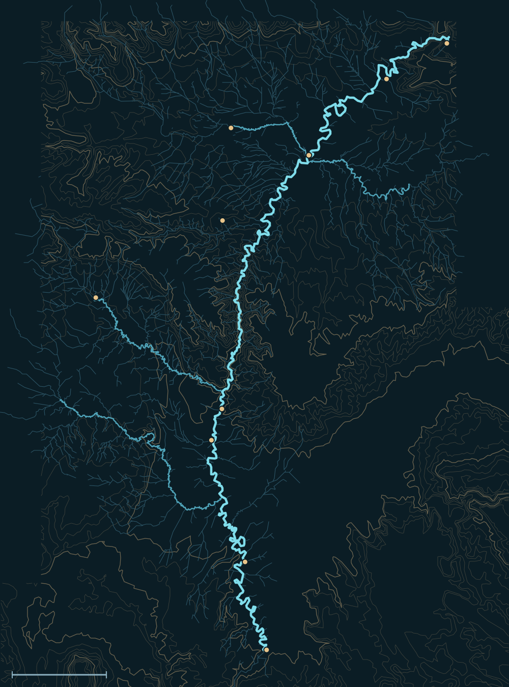
Map of the Green RiverEcho ParkJensenOuraySand WashSwasey's (Gray Canyon)Green River (town)Mineral BottomColorado confluenceMytonWellingtonSan Rafael RiverPrice RiverWhite RiverDuchesne River25 miles
Green River. River lines from the USGS National Hydrography Dataset.

People and the river

The second expedition's boats on the Green just below the Union Pacific bridge at Green River, Wyoming, where both of Powell's trips began.
The second expedition's boats on the Green just below the Union Pacific bridge at Green River, Wyoming, where both of Powell's trips began.Powell Survey (John K. Hillers). U.S. National Archives, public domain · source
Camp in Red Canyon Park on the Green: the photographer, John K. Hillers, mending, 1871.
Camp in Red Canyon Park on the Green: the photographer, John K. Hillers, mending, 1871.Powell Survey (John K. Hillers). U.S. National Archives, public domain · source
Powell's second expedition, 1871: Jones, Hillers and Dellenbaugh in the boat Emma Dean below Hell's Half Mile, Canyon of Lodore.
Powell's second expedition, 1871: Jones, Hillers and Dellenbaugh in the boat Emma Dean below Hell's Half Mile, Canyon of Lodore.Powell Survey, 1871. Public domain · source
  1. For centuriesThe Fremont people left rock art and granaries along the river; the Ute homeland spans its basin.1
  2. 1869John Wesley Powell's expedition launched at Green River, Wyoming, and named much of the canyon country on the way down.2
  3. 1950sA national fight stopped a dam at Echo Park in Dinosaur National Monument; in the trade, conservationists agreed not to oppose Glen Canyon Dam.3
  4. 1960sFlaming Gorge Dam was finished; spring peaks above the Yampa fell by about 60%.4,5

Biggest flows

Stillwater Canyon, the Green's last quiet stretch before it meets the Colorado, 1870s.
Stillwater Canyon, the Green's last quiet stretch before it meets the Colorado, 1870s.Powell Survey (John K. Hillers). U.S. National Archives, public domain · source
Sumner's Amphitheater in Desolation Canyon, named for Jack Sumner of Powell's crew. 1870s.
Sumner's Amphitheater in Desolation Canyon, named for Jack Sumner of Powell's crew. 1870s.Powell Survey. U.S. National Archives, public domain · source
~68,000cfs
Green River at Green River, UT, 1917: the largest gauged flow (1,929 m³/s)6
measured
over 60,000cfs
at Green River, UT, in 1897, 1909, 1917 and 19215
measured

Measured: a USGS gauge reading. Estimated: reconstructed after the fact from high-water marks or flood deposits. Provisional: USGS readings not yet reviewed.

Floods that mattered

Early 1900s

The biggest snowmelt floods of the gauge record all came before Flaming Gorge Dam, between 1897 and 1921.5

Prehistoric floods

At least 14 floods found in canyon deposits were more than twice the largest gauged flow.6

The Green River and its Tributaries
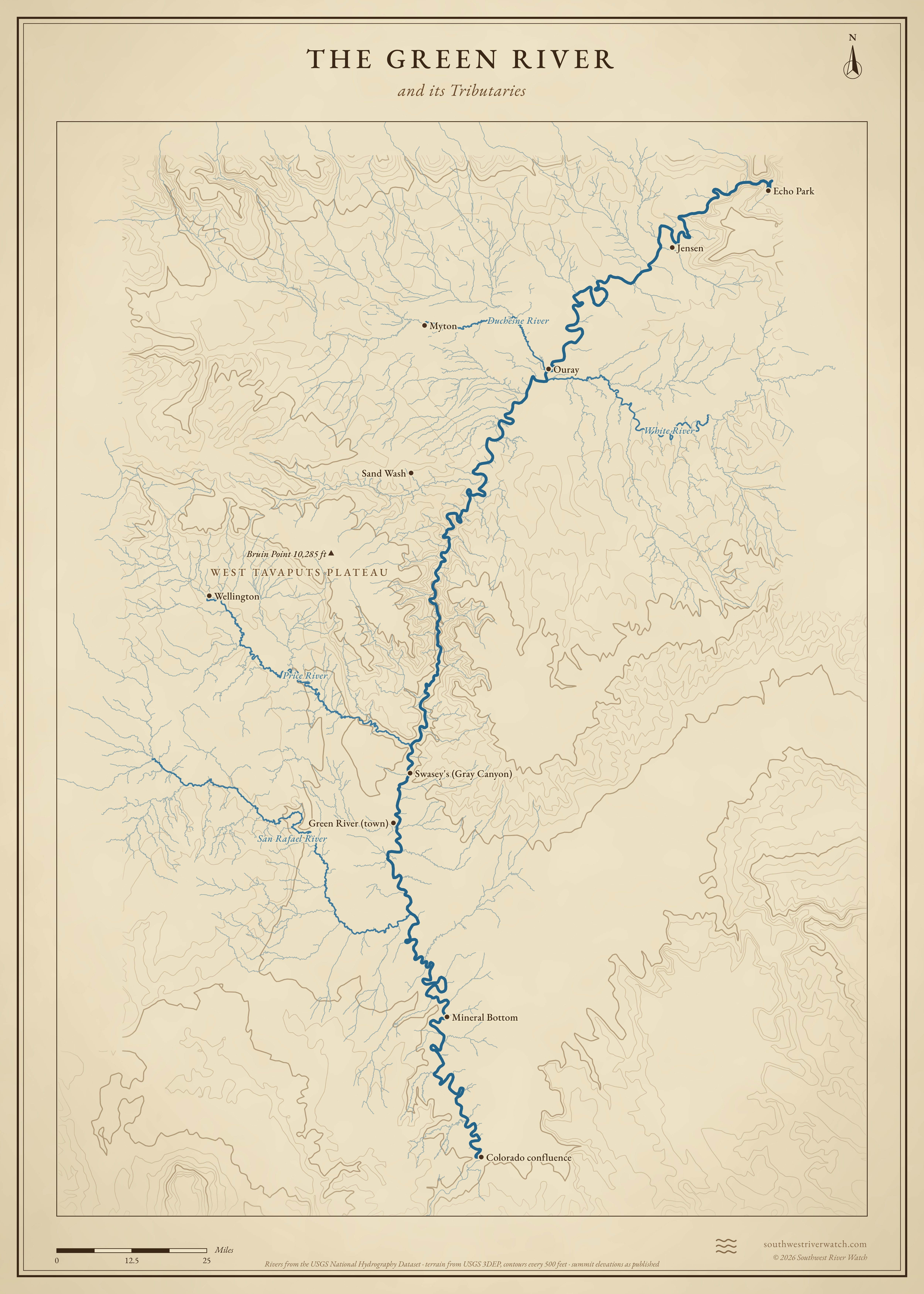
Map of the Green River and its tributaries in eastern Utah, with West Tavaputs Plateau: rivers, side canyons, contour lines and summit elevations, in a classic survey style.
A classic map of the river and the mountains around it. Full size · Vector (SVG) · © 2026 Southwest River Watch
Sources
  1. NPS: Dinosaur National Monument, people
  2. Utah Geological Survey: Powell's 1869 river journey
  3. Utah Humanities: No Dam Here! The Echo Park controversy
  4. Utah History Encyclopedia: Flaming Gorge
  5. Colorado Water Conservation Board: Green River flood history
  6. Univ. of Arizona: Paleoflood hydrology on the lower Green River