Where Kanab Creek and the East Fork come from
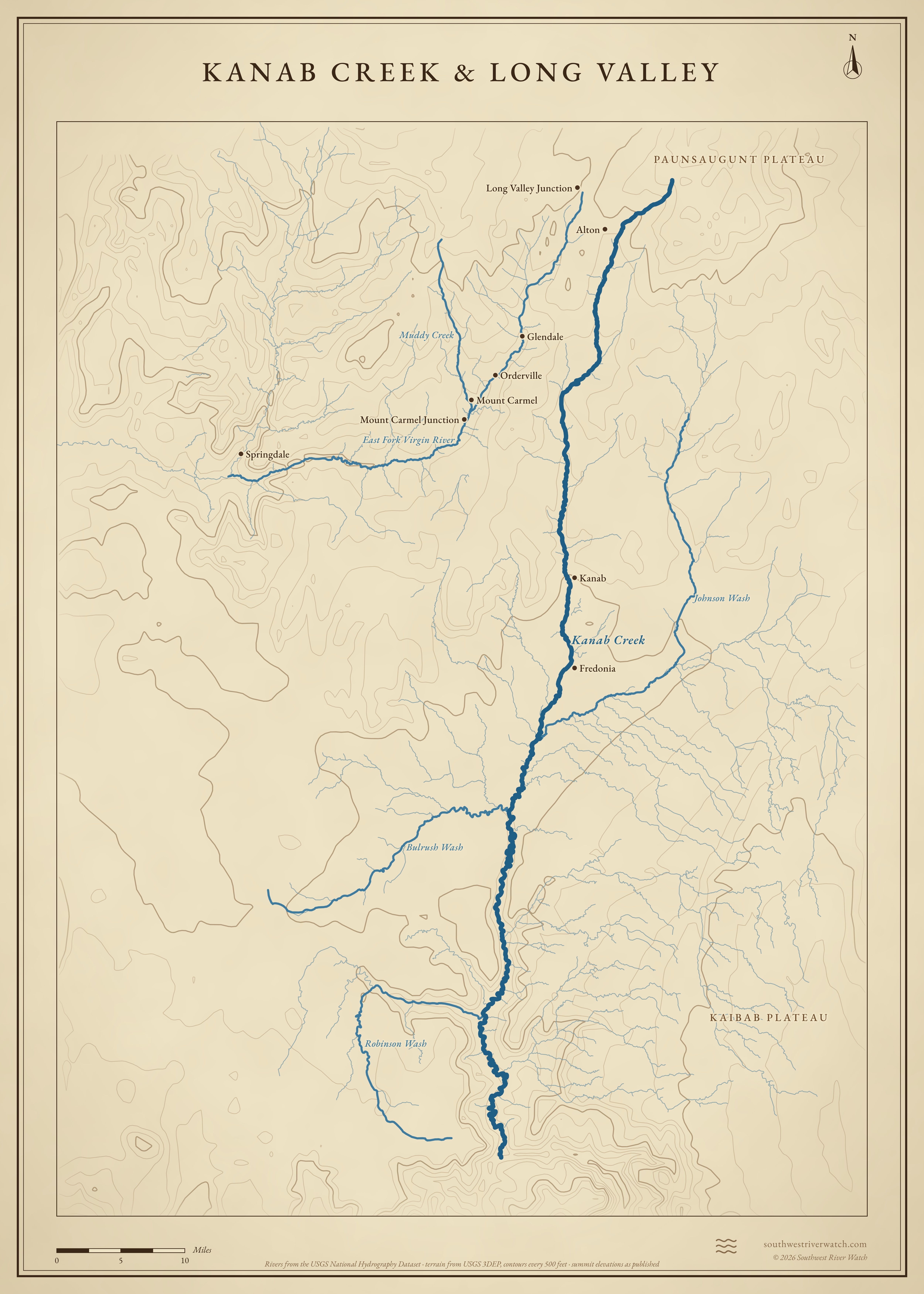
Two streams from the same high country below the Paunsaugunt Plateau: the East Fork of the Virgin down Long Valley to Zion, and Kanab Creek, about 125 miles past Kanab to the Grand Canyon.
 Kanab CreekLong Valley JunctionGlendaleOrdervilleMount CarmelMount Carmel JunctionSpringdaleAltonKanabFredoniaEast Fork Virgin RiverJohnson WashRobinson WashBulrush WashMuddy Creek10 miles
Headwaters
Below the Sunset Cliffs
Kanab Creek begins at about 8,600 feet along the base of the Sunset Cliffs, the southwest edge of the Paunsaugunt Plateau, and runs south past Alton. The East Fork of the Virgin starts close by, near Long Valley Junction.1,2
Long Valley
The East Fork runs south down Long Valley beside US-89, past Glendale, Orderville and Mount Carmel. Below Mount Carmel Junction it turns west and cuts into the White Cliffs, forming Parunuweap Canyon, about 25 miles long, and meets the North Fork just south of Springdale.2,3
Kanab Creek to the Grand Canyon
Kanab Creek passes Kanab and Fredonia, then cuts a deep canyon across the Kanab Plateau and joins the Colorado at about 1,900 feet, at river mile 143 in Grand Canyon National Park.1,4
The river, top to bottom
- Sunset CliffsKanab Creek and the East Fork begin a few miles apart.
- Long ValleyThe East Fork past Glendale, Orderville and Mount Carmel.
- Mount Carmel JunctionThe East Fork turns west into Parunuweap Canyon.
- SpringdaleThe East Fork meets the North Fork; the Virgin begins.
- KanabKanab Creek leaves its canyon and passes the town.
- FredoniaJohnson Wash comes in from the east.
- Kanab Creek WildernessSnake Gulch, Jumpup and Hack canyons join.
- Colorado RiverRiver mile 143, in the Grand Canyon.
Main tributaries
| Stream | Joins | Notes |
|---|---|---|
| East Fork Virgin River | North Fork, near Springdale | Long Valley, then Parunuweap Canyon. |
| Muddy Creek | East Fork, near Mount Carmel Junction | Desert creek; flashes in storms. |
| Johnson Wash | Kanab Creek, near Fredonia | Drains Johnson Canyon east of Kanab. |
| Snake Gulch & Jumpup Canyon | Kanab Creek canyon | The main side canyons from the east. |
| Hack, Grama & Chamberlain canyons | Kanab Creek canyon | From the west, off the Kanab Plateau. |
Floods
Both streams flood mostly from summer thunderstorms. Kanab Creek's floods cut its deep arroyo through Kanab in the 1880s; the East Fork carries its storm water through Parunuweap Canyon to the Virgin at Springdale, so a storm over Long Valley adds to the Virgin's floods downstream.5,2 The live map watches the gauges along the way.
Kanab Creek & Long Valley