Lower Colorado River
Lower Colorado River
Lees Ferry, Marble Canyon and the Grand Canyon: since 1963 the river's flow is set mostly by Glen Canyon Dam, but floods still pour in from the side canyons.
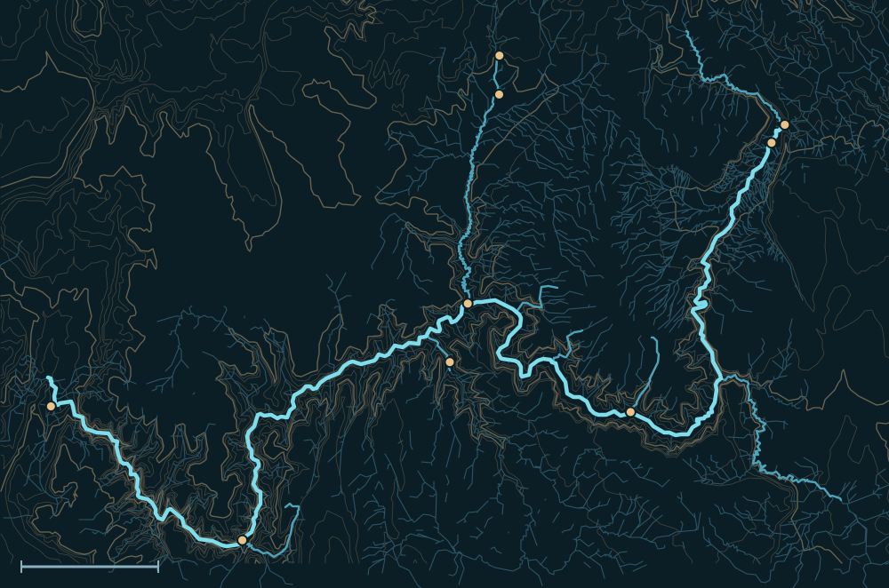 Kaibab PlateauCoconino PlateauUinkaret MountainsColorado RiverLees FerryNavajo BridgePhantom RanchKanabFredoniaKanab Creek mouthSupaiDiamond CreekPearce Ferry25 miles

People and the river

- For centuriesAncestral Puebloans, and the Havasupai, Hualapai, Hopi, Navajo and Southern Paiute peoples, lived in and around the canyon.1
- 1869Powell's expedition made the first recorded trip through the Grand Canyon.2
- 1872John D. Lee started his ferry at Lees Ferry, still the starting point for Grand Canyon river trips.3
- 1919Grand Canyon became a national park.1
- 1963Glen Canyon Dam began holding back the river's floods and sediment.4
Biggest flows

210,000–300,000cfs
estimated~51,000cfs
Colorado near Grand Canyon (Phantom Ranch), Oct 23, 2026, fed by the Little Colorado and Paria7
provisional readingMeasured: a USGS gauge reading. Estimated: reconstructed after the fact from high-water marks or flood deposits. Provisional: USGS readings not yet reviewed.
Floods that mattered
Aug 2008: Havasu Creek
Overnight storms and a small dam failure upstream flooded Havasu Canyon; more than 400 campers and residents were evacuated from Supai.8,9
Oct 2026
The Little Colorado ran near 18,000 cfs at Cameron and the Paria above 5,000 cfs, pushing the Colorado at Phantom Ranch past 50,000 cfs (provisional).7
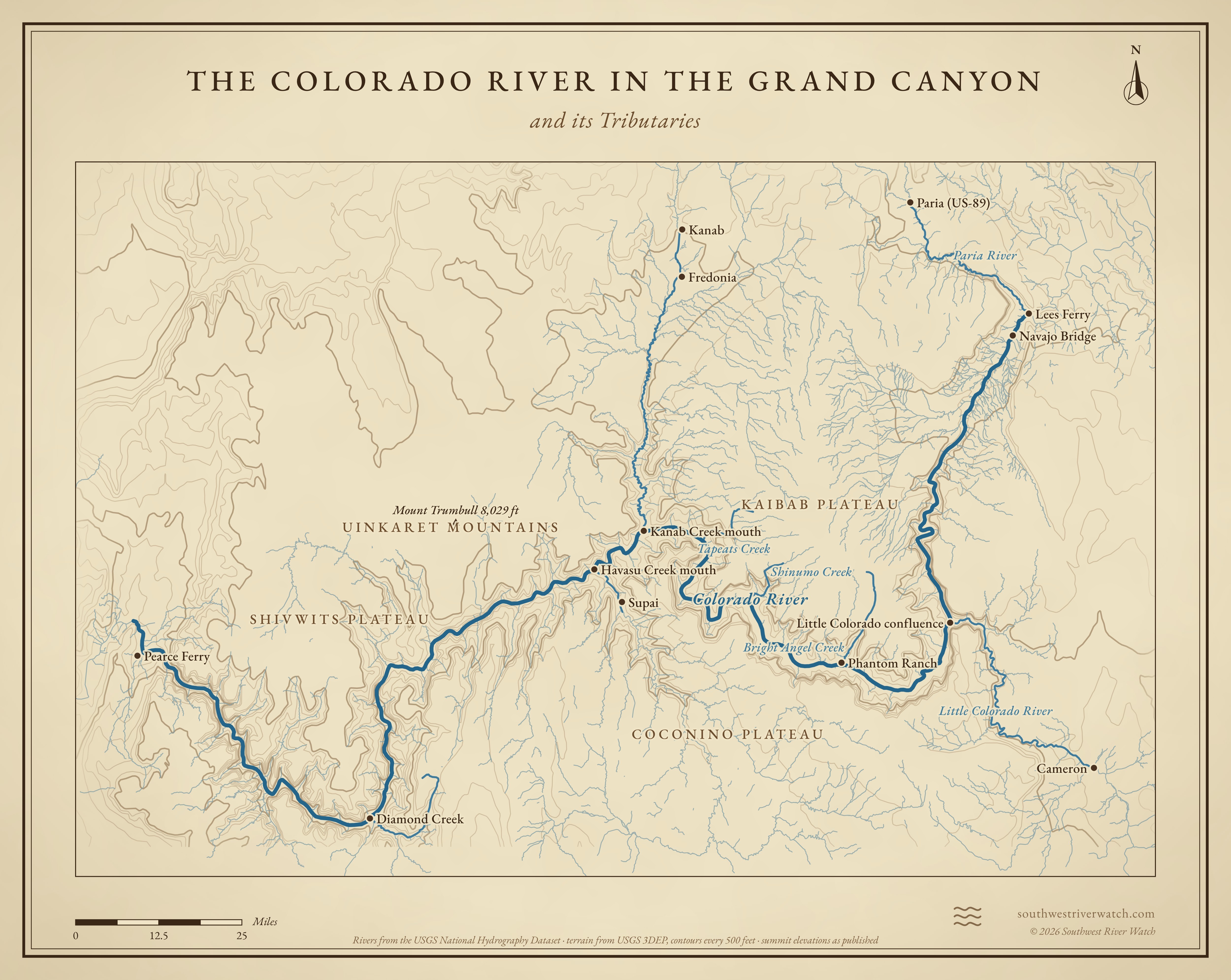
The Colorado River in the Grand Canyon and its Tributaries
Sources
- NPS: Grand Canyon history and culture
- Utah Geological Survey: Powell's 1869 river journey
- NPS: Crossing of the Fathers, Explorers and Settlers
- Bureau of Reclamation: Glen Canyon Unit
- USGS: Floods of the Colorado River at Lees Ferry, reanalysis (PP 1677)
- Eric Kuhn: Floods on the Colorado
- NOAA National Water Model archive of USGS 15-minute readings (provisional)
- NBC: Grand Canyon flooding forces evacuation of 400 people (Aug 2008)
- Supai, Arizona (Wikipedia)