Where the Salt River comes from
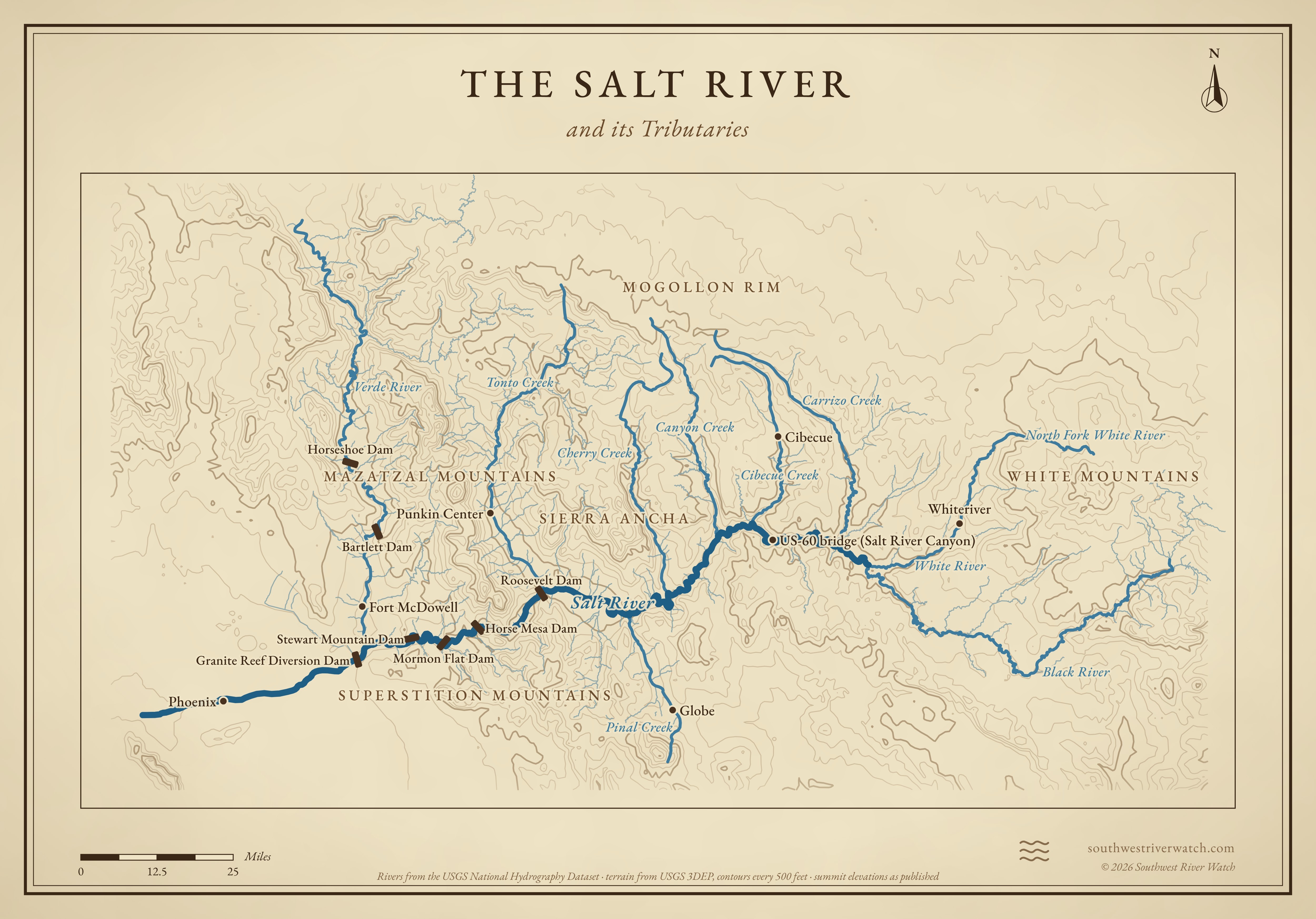
Nearly 200 miles from the White Mountains of eastern Arizona, through the Salt River Canyon and four reservoirs, to the Gila below Phoenix.
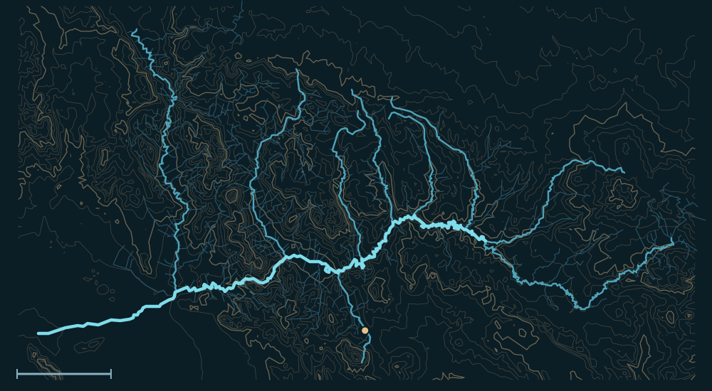 White MountainsMogollon RimSierra AnchaMazatzal MountainsSuperstition MountainsSalt RiverGlobeVerde RiverBlack RiverCarrizo CreekPinal CreekWhite River25 miles
Headwaters
The White Mountains
The Salt begins where the White and Black rivers meet, in the valley between the Mogollon Rim and the Natanes Plateau. Both are fed by springs and creeks in the White Mountains of eastern Arizona and by snowmelt from Mount Baldy, about 11,400 feet.1,2,3
Between two reservations
The Black River, and then the Salt, form the boundary between the Fort Apache Indian Reservation (White Mountain Apache) to the north and the San Carlos Apache Reservation to the south.1,2
Dams, then the desert
Below the Salt River Canyon the river fills Roosevelt, Apache, Canyon and Saguaro lakes. Near Fountain Hills the Verde joins it, and at Granite Reef Diversion Dam most of the water goes into the Valley's canals; through Tempe and Phoenix the bed is usually dry until the Salt meets the Gila.1,4
The river, top to bottom
- White MountainsThe North Fork of the White River and the Black River gather snowmelt from Mount Baldy.
- White and Black rivers meetThe Salt begins; Carrizo and Cibecue creeks come in from the Mogollon Rim.
- Salt River CanyonUS-60 crosses at the bottom; Canyon and Cherry creeks join below.
- Roosevelt LakeTonto Creek comes in from the Mogollon Rim, Pinal Creek from Globe.
- Apache, Canyon and Saguaro lakesBehind Horse Mesa, Mormon Flat and Stewart Mountain dams.
- Verde RiverJoins near Fountain Hills, below Horseshoe and Bartlett dams.
- Granite Reef Diversion DamMost of the water goes into the Valley's canals.
- PhoenixUsually a dry bed through the city; the Salt meets the Gila to the southwest.
Main tributaries
| Stream | Joins | Notes |
|---|---|---|
| Black River | Head of the Salt | From the White Mountains; the reservation boundary. |
| White River | Head of the Salt | North and East forks from Mount Baldy, past Whiteriver. |
| Carrizo & Cibecue creeks | Upper Salt | From the Mogollon Rim, through the Fort Apache reservation. |
| Canyon & Cherry creeks | Salt River Canyon to Roosevelt | From the Rim and the Sierra Ancha. |
| Tonto Creek | Roosevelt Lake | From the Mogollon Rim near Payson; flashes in storms. |
| Pinal Creek | Roosevelt Lake | Past Globe and Miami. |
| Verde River | Near Fountain Hills | The Salt's biggest tributary; Horseshoe and Bartlett dams. |
Why it matters for floods
The Salt's big floods come in winter, when storms rain on snow in the White Mountains and along the Mogollon Rim and fill the reservoirs; when the dams have to release, water runs through Phoenix's normally dry riverbed, as in 1978 and 1980. Summer thunderstorms flash the side canyons below the dams.5,1 The live map watches the gauges along the way.
The Salt River and its Tributaries