San Juan River
San Juan River
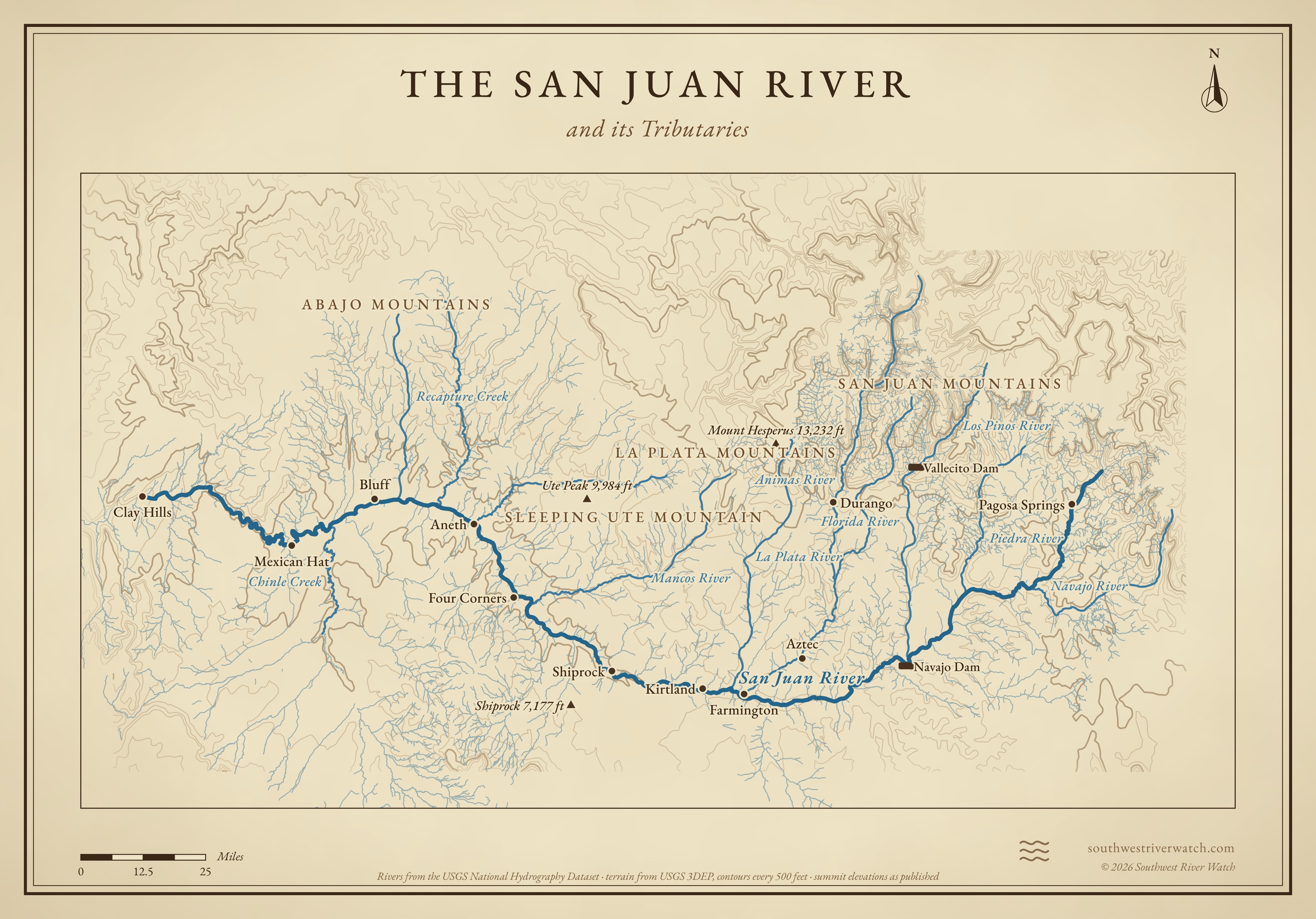
From the San Juan Mountains through Farmington and the Navajo Nation to Lake Powell; its largest known flood came from days of fall rain, as October 2026's did.
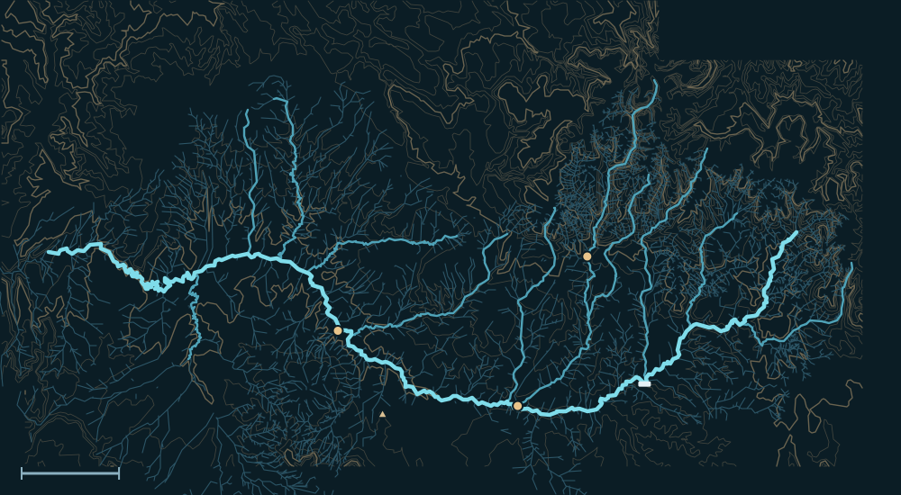 San Juan MountainsLa Plata MountainsAbajo MountainsSan Juan RiverShiprock 7,177 ftDurangoFarmingtonFour CornersNavajo DamMancos RiverChinle Creek25 miles
People and the river

- For centuriesAncestral Puebloan towns lined the river and its tributaries; today it runs through Diné (Navajo), Ute Mountain Ute and Southern Ute homelands and forms much of the Navajo Nation's northern edge.1
- 1880Hole-in-the-Rock pioneers reached the river and founded Bluff.1
- 1962Navajo Dam began storing water above Farmington, taming the main stem's spring floods. The Animas, its biggest tributary, still runs free.2
- Aug 5, 2015The Gold King Mine blowout above Silverton sent about 3 million gallons of acidic, metal-laden water down the Animas and the San Juan, through some 200 miles of Navajo land.3,4
Biggest flows
~150,000cfs
San Juan near Bluff, Oct 6, 1911: the largest flood known there, likely in many centuries5
estimatedMeasured: a USGS gauge reading. Estimated: reconstructed after the fact from high-water marks or flood deposits. Provisional: USGS readings not yet reviewed.
Floods that mattered

Oct 1911: the Four Corners flood
Days of heavy rain swept away bridges, farms and parts of towns from Pagosa Springs and Durango to Farmington and Bluff.7,5
Oct 2026
A long fall storm on soaked ground sent the San Juan, Animas and their tributaries far over their banks; readings below are provisional.6
The San Juan River and its Tributaries
Sources
- Utah History Encyclopedia: San Juan River
- Navajo Dam (Bureau of Reclamation project history, via Wikipedia)
- Arizona DEQ: Gold King Mine spill
- 5280: How the Gold King Mine spill threatens the Navajo Nation
- USGS: Paleoflood hydrology of the San Juan River near Bluff (OFR 01-314)
- NOAA National Water Model archive of USGS 15-minute readings (provisional)
- KSUT: The 1911 Four Corners flood, could it happen again?