Where the Green River comes from
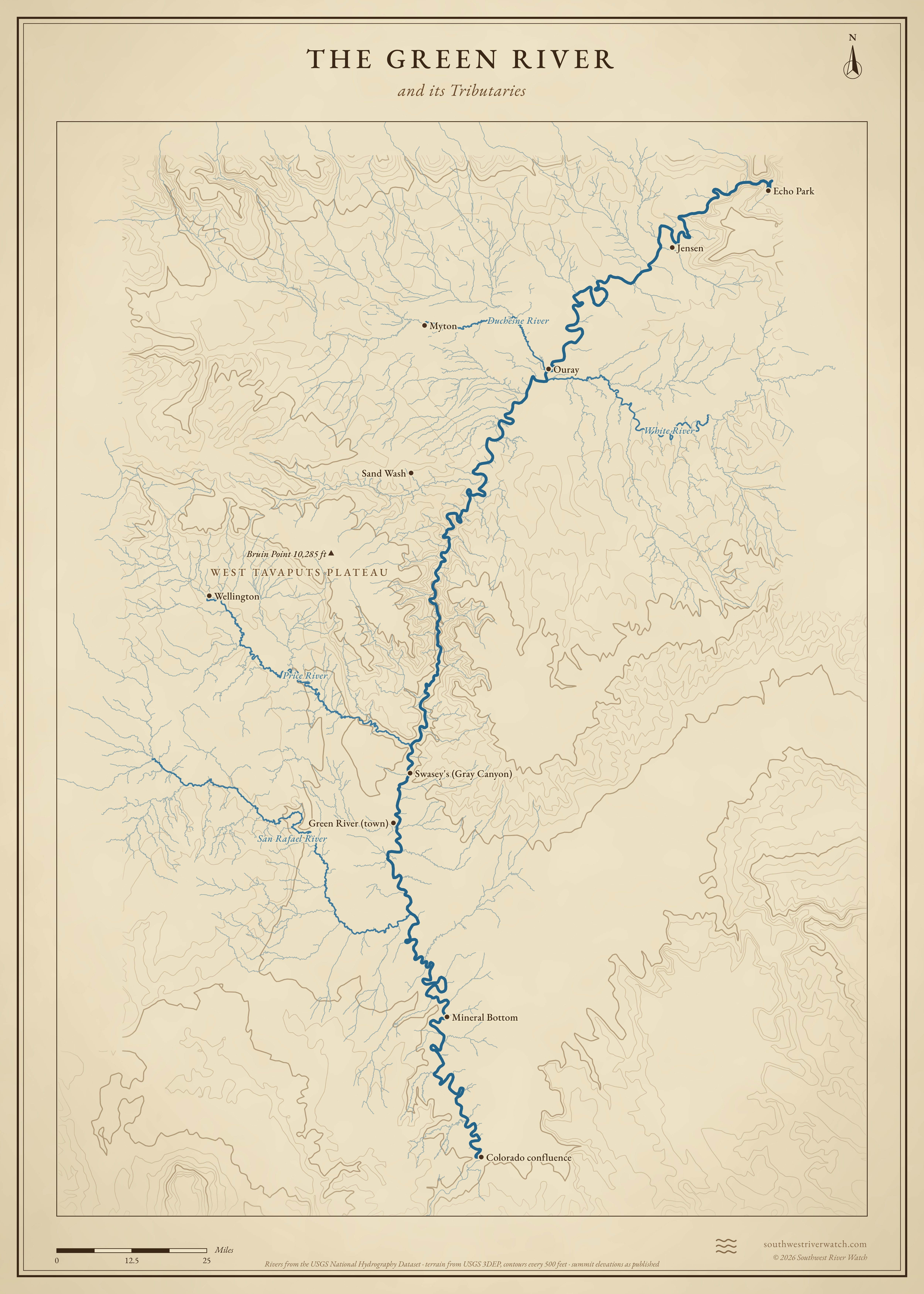
About 730 miles from the Wind River Range in Wyoming, through Flaming Gorge and the Uinta Basin, to the Colorado River in Canyonlands.
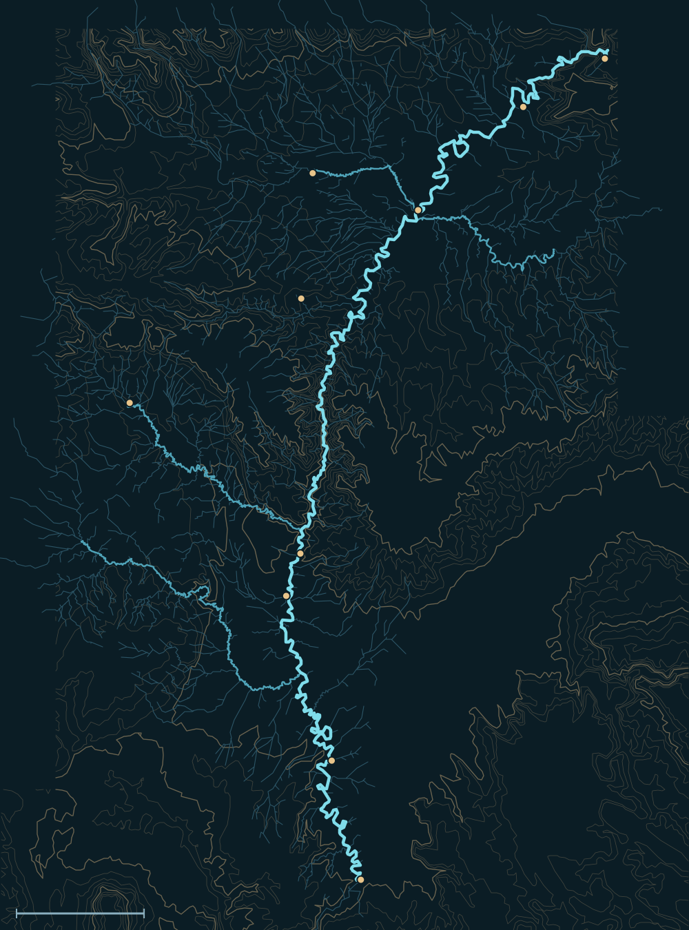 Echo ParkJensenOuraySand WashSwasey's (Gray Canyon)Green River (town)Mineral BottomColorado confluenceMytonWellingtonSan Rafael RiverPrice RiverWhite RiverDuchesne River25 miles
Headwaters

The Wind River Range
The Green River begins in the glaciers and snowfields of the Wind River Range in western Wyoming and flows out through the Green River Lakes. It runs south across the Wyoming basins, the largest tributary of the Colorado.1
Flaming Gorge
On the Wyoming–Utah line, Flaming Gorge Dam (finished in 1964) holds the river in a long reservoir. Its releases set the river's flow through Browns Park and the Gates of Lodore.2
The Yampa and the Uinta Basin
At Echo Park in Dinosaur National Monument the Yampa, one of the last big undammed rivers in the basin, joins. In the Uinta Basin the Duchesne comes in from the Uinta Mountains and the White River from Colorado's Flat Tops.3,4,5
The river, top to bottom


- Wind River Range, WYThe river starts at the Green River Lakes.
- Flaming Gorge DamHolds and releases the upper river.
- Echo Park, DinosaurThe Yampa joins.
- Uinta Basin near OurayThe Duchesne and White rivers join.
- Desolation & Gray canyonsA deep canyon through the Tavaputs Plateau; the Price River joins.
- Town of Green River, UTThe river leaves the canyons.
- Labyrinth & Stillwater canyonsThe San Rafael River joins; the river meanders into Canyonlands.
- The ConfluenceMeets the Colorado in Canyonlands National Park.
Main tributaries


| Stream | Joins | Notes |
|---|---|---|
| Yampa River | Echo Park | Mostly undammed; big snowmelt peaks. |
| Duchesne River | Near Ouray, UT | From the Uinta Mountains; much of it diverted. |
| White River | Near Ouray, UT | From the Flat Tops in Colorado. |
| Price River | Gray Canyon | From the Wasatch Plateau; flashy summer floods. |
| San Rafael River | Below Green River, UT | Drains the San Rafael Swell. |
Why it matters for floods
Snowmelt from the Rockies and Uintas brings the Green its high water in May and June, partly held by Flaming Gorge. Summer storms over the Price and San Rafael and the canyon country below the Uinta Basin can add sudden, muddy surges.1,2 The live map watches the gauges along the way.
The Green River and its Tributaries