Where the Grand Canyon's water comes from
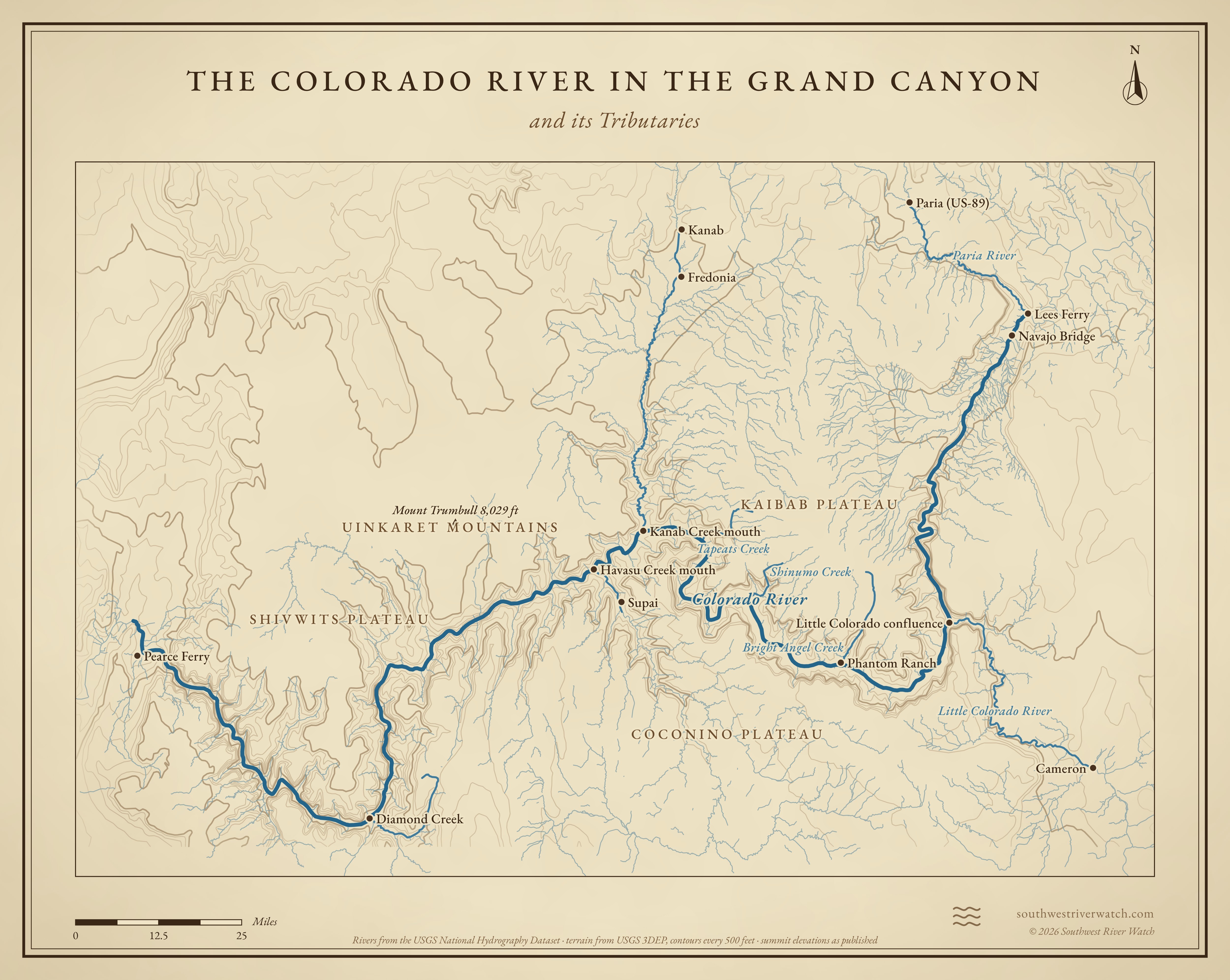
From Glen Canyon Dam and Lees Ferry, about 280 miles through the Grand Canyon to Lake Mead.
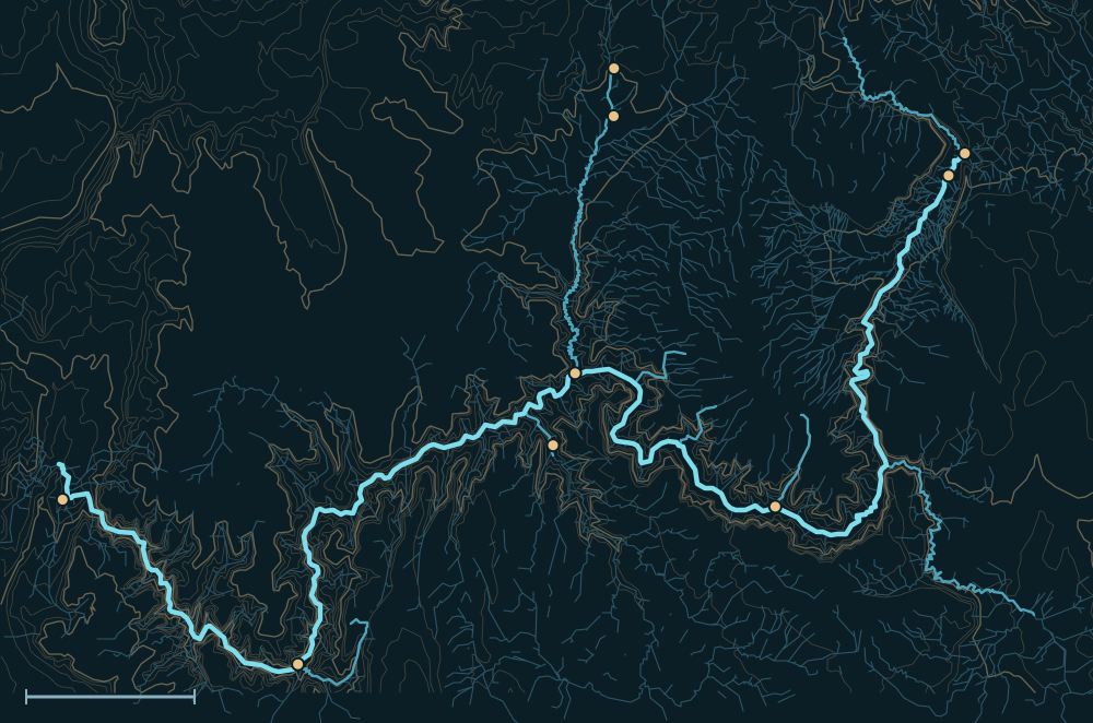 Kaibab PlateauCoconino PlateauUinkaret MountainsColorado RiverLees FerryNavajo BridgePhantom RanchKanabFredoniaKanab Creek mouthSupaiDiamond CreekPearce Ferry25 miles
Headwaters

Released from Lake Powell
Almost all of the Colorado's water in the Grand Canyon is released from Glen Canyon Dam, upstream of Lees Ferry. It comes from deep in Lake Powell, so it runs cold and clear, and its flow follows the dam's release schedule rather than the seasons.1,2
The Paria and the Little Colorado
The Paria joins at Lees Ferry and the Little Colorado about 60 miles below. Both are desert rivers that carry most of the canyon's mud and sand now that the dam traps the rest. The Little Colorado rises in the White Mountains of Arizona; near its mouth, Blue Springs turns it turquoise.3,4
Springs and side canyons
Bright Angel, Tapeats and Havasu creeks are fed by springs below the canyon rims; Havasu Creek's blue-green water runs through Supai. Kanab Creek drains a long canyon from southern Utah.5,6,1
The river, top to bottom

- Glen Canyon DamReleases from Lake Powell.
- Lees FerryThe Paria joins; the Grand Canyon begins.
- Marble CanyonAbout 60 miles of canyon to the Little Colorado.
- Little Colorado confluenceBlue water and much of the canyon's sediment.
- Phantom RanchBright Angel Creek joins below the South Rim trails.
- Shinumo, Tapeats & KanabSide creeks from the north.
- Havasu CreekFrom Supai and the Havasupai Reservation.
- Diamond CreekThe only road to the river inside the canyon.
- Lake MeadThe river meets the lake near Pearce Ferry.
Main tributaries


| Stream | Joins | Notes |
|---|---|---|
| Paria River | Lees Ferry | From near Bryce Canyon; very muddy floods. |
| Little Colorado River | About river mile 61 | The biggest side river; dry or blue most of the year, brown in flood. |
| Bright Angel Creek | Phantom Ranch | Spring-fed from the North Rim. |
| Kanab Creek | Kanab Canyon | Long canyon from southern Utah. |
| Havasu Creek | Below Supai | Spring-fed; flash floods have hit Supai. |
| Diamond Creek | Lower canyon | Hualapai land; take-out road. |
Why it matters for floods
The dam keeps the main river steady, so floods in the Grand Canyon now come from the side rivers. Summer storms over the Paria, the Little Colorado and the side canyons can raise the river by thousands of cubic feet per second in hours, and turn it brown.1,4 The live map watches the gauges along the way.
The Colorado River in the Grand Canyon and its Tributaries