Where the San Juan River comes from
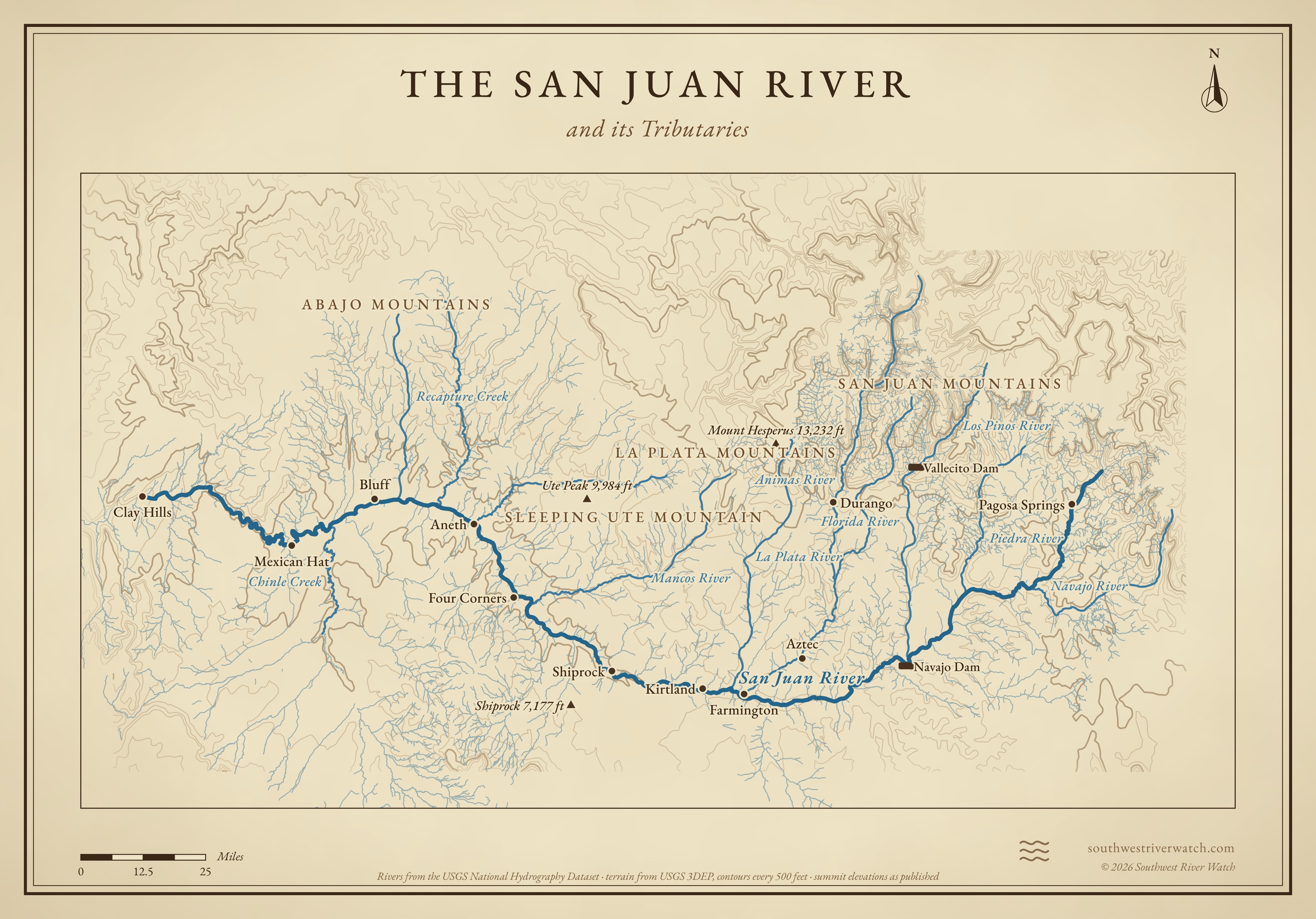
About 380 miles from the San Juan Mountains of Colorado, through New Mexico and the Four Corners, to Lake Powell.
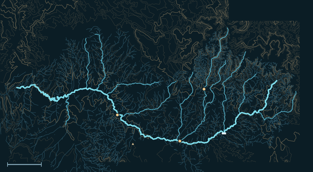 San Juan MountainsLa Plata MountainsAbajo MountainsSan Juan RiverShiprock 7,177 ftDurangoFarmingtonFour CornersNavajo DamMancos RiverChinle Creek25 miles
Headwaters

Two forks below the Continental Divide
The San Juan begins high in the San Juan Mountains of southwestern Colorado. Its East and West Forks drain the slopes near Wolf Creek Pass and join north of Pagosa Springs. Snowmelt from these mountains is most of the river's water.1
Navajo Lake
Just across the New Mexico line the river is held back by Navajo Dam, finished in 1962. The Piedra and Los Pinos rivers and the Navajo River reach the river in or above the reservoir, so their floods are held there too.2,1
The Animas
Below the dam the biggest addition is the Animas River, which rises around Silverton in the San Juan Mountains and joins at Farmington. It is not dammed, so its spring snowmelt and fall storm floods reach the San Juan in full.3
The river, top to bottom
- San Juan MountainsEast and West Forks join above Pagosa Springs.
- Navajo LakePiedra, Los Pinos and Navajo rivers; Navajo Dam controls releases.
- FarmingtonThe Animas and La Plata join.
- Four CornersThe Mancos comes in from Mesa Verde country.
- Aneth & Montezuma CreekMcElmo and Montezuma creeks join from the north.
- BluffRecapture Creek joins; Chinle Creek comes in from Arizona below town.
- Mexican Hat & the GoosenecksThe river winds through deep entrenched meanders.
- San Juan arm, Lake PowellThe river ends in the lake, in Glen Canyon.
Main tributaries

| Stream | Joins | Notes |
|---|---|---|
| Animas River | Farmington, NM | From Silverton; the largest tributary and the one most likely to flood. |
| Navajo, Piedra, Los Pinos | Navajo Lake | Mountain rivers mostly held by the reservoir. |
| La Plata River | Farmington, NM | From the La Plata Mountains. |
| Mancos River | Near Four Corners | Drains Mesa Verde; can run hard in summer storms. |
| McElmo & Montezuma creeks | Near Aneth, UT | Desert creeks that flash after storms. |
| Chinle Creek | Below Bluff, UT | Drains a large part of the Navajo Nation in Arizona. |
Why it matters for floods
Spring snowmelt brings the San Juan its long high water, mostly from the Animas now that Navajo Dam holds the upper river. Its biggest floods came in fall, when tropical moisture stalled over the mountains. Summer storms over the desert creeks below Farmington send fast, muddy surges toward Bluff and Mexican Hat.4,1 The live map watches the gauges along the way.
The San Juan River and its Tributaries